Seeing Secrets Underground
Interview with
Meera - These days when searching for ancient remains and hidden treasures you don't need to have the magical map where X marks the spot. You can now see into the ground using the powers of geophysics to find X for yourself. This week I'm in Leighton Buzzard in Bedfordshire to find out how to hunt for ancient remains myself. Here to help me is Chris Leech, geophysicist and director of Geomatrix Earth Sciences Ltd.
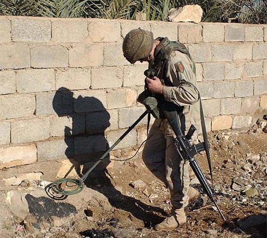 Chris L - Geophysics is really the science of trying to find what is down below the ground without actually having to dig a hole. We're looking for changes in the physical properties of the ground. If you've got a 10 hectare site that you're interested in and you think there might be archaeology underneath it you're going to have to dig an awful lot of holes in the ground if you don't do geophysics first. With the geophysics it allows you to very rapidly, relatively cost-effectively narrow-down the area which is of great interest to the real archaeologists.
Meera - What are the techniques used?
Chris L - There are several techniques which are useful for archaeological geophysics. We tend to look for the magnetic signatures of the ground. We tend to look for the electrical properties of the ground. Also we use the growing technique of ground-penetrating radar therefore looking at the electromagnetic properties of the ground.
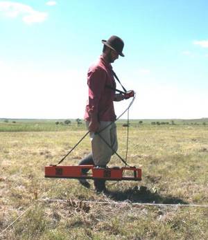
Meera - The equipment that you have strapped to yourself here is basically a horizontal pole with two vertical poles attached at either side and a rucksack that's strapping you into it, really. Which technique does this piece of equipment use?
Chris L - This is a magnetometer. Therefore we are actually measuring precisely changes in the Earth's magnetic field at this point. The two vertical poles are actually two separate magnetometers so you can measure the Earth's magnetic field in two places at the same time. The horizontal pole you described feeds the data back into a small data logger. By having two magnetometers we can speed up our operation. We can acquire two lines of data right at the same time.
Meera - How does a magnetometer actually measure the magnetic field beneath it?
Chris L - Each of the tubes which we mentioned earlier contains two fluxgate sensors. These measure very precisely the Earth's magnetic field in the vertical component. By measuring it in two different places we can get a measure of the change in the magnetic field over that distance which is 1m between each sensor. We're measuring the vertical gradient of the Earth's magnetic field in two places simultaneously.
Meera - How does this then translate to tell you where things are located?
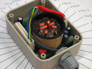 Chris L - All materials have got a magnetic signature be it different types of soils or manmade objects such as bricks or artefacts of some description. If we can measure the magnetic field with sufficient accuracy and sufficient resolution as we go over the ground we can see very small changes in the Earth's magnetic field.
Meera - So you have this magnetometer set up and strapped on, ready to go. What's the next step to take a reading from this field that we're in?
Chris L - Well, we've got our grid set out. We're at our starting point so all I need to do is press go.
beep... beep... beep...
Meera - So what's happening now?
Chris L - We can see the data being acquired on the screen. We can see numerical values being displayed and the beeping that you can hear is just telling us that the instrument is working. Every time it takes a reading we get the beep.
Meera - How do you go from scanning an area to producing an entire map pinpointing the hotspots of where's good to dig?
 Chris L - The traditional way of doing it with archaeology is to divide your field up into a series of grid which may be 20 or 30m square. Then you'll walk up and down lines maybe 1 or 2m or if it's a high resolution survey 0.5m apart and so on, creating these grids until you've covered the whole area. The more modern way of doing it is to use GPS in which case you don't have to lay out your grids. The GPS will navigate you up and down lines. Once we have covered that we can then take the data back to our office and using a mapping programme we can then produce a map in various styles which highlight various different archaeology or soil types if you're doing geoarchaeology, for example. Once we've got a map we can start to see the patterns emerging. We're obviously going to get a lot of background clutter which will just be naturally occurring rocks and other pieces of what I would call junk which maybe things like nails which have fallen off people's shoes or horse shoes or beer bottle, cans etc etc. These little things you can't really see when you're out in the field. You can't tell if they're real archaeology or if they're man-made rubbish. Once we've made a map out of them we can tell one from the other.
Meera - So, out in the field I just need to stick to my grid and record regular measurements to cover the whole area. I'm off to hunt for some treasure!
beep... beep... beep...



Comments
Add a comment