What can satellites reveal about earthquakes?
Interview with
Chris - Now a few weeks on from what happened in Haiti, the whole situation there is still making news because of the sheer scale of the devastation. But what about the actual earthquake itself? What are scientists beginning to learn from observing the land as it now is following the quake. Well, James Jackson is professor of active tectonics at Cambridge University and he's with us. Hello James.
James - Hello.
Chris - Welcome to The Naked Scientists. Tell us a little bit, if you can, about how scientists are now beginning to follow-up what's happened in Haiti to try to understand more about what caused it in the first place and what's likely to come in the future.
James - We have a range of tricks now we can use to really do a forensic job on what happens in earthquakes, wherever they are. Some are space-based techniques, one of which is called radar interferometry. What we use here are satellites, which pass over the earth and send a radar beam down on the surface of the earth and it reflects back to the satellite. This is similar to the way people are used to hearing about how radar can monitor aeroplanes or ships look for other ships at sea by sending a beam out and measuring how long it takes to come back, which tells you how far away that object is.
What these satellites do is pass over the planet's surface. They take an image of the ground before the earthquake and then take another image of the ground after the earthquake. You can then compare the two and see how the ground has moved. We can do this now fairly regularly over most of the land surface of the earth and we can measure how much the ground has moved to an accuracy of a few centimetres. Maybe that sounds a lot or little to you - a few centimetres - but the actual signal in the earthquake - the 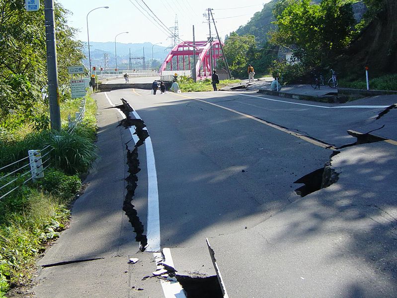 amount the ground moves - is between 2 and 5 metres. So the signal to noise ratio is fantastic; it's very easy to see this. There are various problems with it of course. The satellite itself is in a polar orbit, which means it orbits from north to south and the Earth rotates underneath it. So the satellite makes a track across the earth and every time it goes around, the earth has spun around a little bit more so it makes the track over a different place. So the satellite only repeats over the same track about every 30 or 40 days or something of that sort.
Chris - Which is why we've seen this little delay between the earthquake happening and now we're getting the data.
James - Yes, the data is now coming through. But not all satellites are the same. There's another effect we have to watch out for which is these satellites were not designed to do this. So the satellites which are up there were mostly designed to monitor the sea surface, because what you can monitor very easily and accurately is the height of the sea surface anywhere and that is how you monitor things like the El Niño, the big weather effects, which are the real reason for putting those satellites up there. So they were designed to look at the oceans and you have a particular optimal wavelength for doing that, which is about 5 centimetres. That's actually not very good for land because it scatters off things which are about 5 centimetres in size like leaves on trees. And places 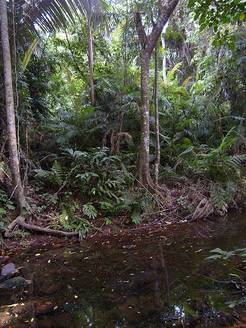 like Hispaniola - and most of the Caribbean - is covered in jungle, so that's not very good. So there's another satellite, which uses a longer wavelength of about 15 centimetres. This is good, it sees through trees. But it doesn't repeat quite as often as the other ones, so we have had to wait quite a long time to get the data from this. But we now have some images of Hispaniola.
Chris - What is this showing and what can we learn from it? Are our initial suspicions about what happened actually correct on the basis of what these satellites are revealing?
James - Yes, because there are also other ways we can get [the same informaton]. We also have seismology, which is the sound that comes out of the earthquake, to see what's happened and we can also use GPS, which is the precise movement of points on the ground. It's the same technology used for sat-navs in cars, but rather more precise. So these things combined together are very much more powerful than each one on its own.
Chris - What are they revealing?
James - They're revealing the length of the fault which moved, how much it moved, where it moved most, what's the distribution of slip along that fault, and how's the ground moved as a response to that earthquake. What you see is that the ground moves. It moves up and down, and sideways: a few metres in this earthquake - but if it does it hundreds of times in hundreds of earthquakes, it produces a landscape. And so what you learn about is the relation between the landscape and the way these faults move. And then you can recognize signals in the landscape which tell you about these faults before they move. So you can actually go to a place and say, "Yes. I know why the land looks like that because I've seen it before somewhere else." And that is what saves lives. It's that step which is now fairly routine in places like California and Japan, which allows the engineers to know what they're up against and design things that don't fall down.
Chris - One snag of course is that everywhere on earth is different or, you could argue, everywhere is unique to a certain extent and what goes for Haiti may not necessarily go elsewhere. So there will be a degree of geographic specificity, won't there? And therefore, you need to have a long term data set I suppose, in order to get close to understanding how that bit of the Earth's surface performs and behaves.
James - The circumstances are different. So Haiti is covered in jungle, Iran's covered in desert, which is much easier to see things. The way the faults move are not very different because they're obeying pretty basic laws of physics, which we understand at that level. We understand what happens if you move a fault that size and in the way it moved. It may be hard to see the signals in the landscape because they're not preserved in places that rain very heavily or are covered in ice or snow or so on. It's harder to see than in a desert. So, that's why we do these things all the time because you're right, you build up a databank of experience essentially, where you see bits of the story in some places, but you recognise the bits you can't see because actually, you've seen them somewhere else.
- Previous 10th Naked Anniversary!
- Next Crisis Camps




Comments
Add a comment