Scientists at the University of Maryland have teamed up with Google 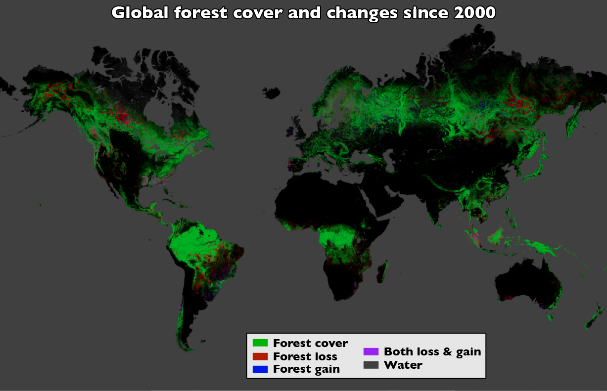 and NASA to produce a global map of forest-cover change.
The group used global satellite data to generate a map of the whole world to a resolution of 30m. To do this on a single computer would have taken 15 years, but, using the cloud computing system created to run Google Earth, they processed the data in a matter of days.
The project includes records from the year 2000 to 2012 and will be updated each year with the latest data.
The map tracks the global tree coverage, as well as losses and gains in forested areas. Already it's revealed that, over the 12 year study period, losses of of 2.3 million square kilometres of forest have occurred worldwide. That's equivalent to twice the land area of South Africa.
Over the same timeframe, the amount of replanted forest was only around 800,000 square kilometres.
Previously we've relied on self-reporting from countries on the levels of deforestation, which is likely to be unreliable. But this map has an independent global scope and it surveys the whole world using the same measures, so it can be used to hold countries to account, and reinforce conservation efforts.
In this regard, Brazil's efforts to reduce deforestation have, the study shows, been working; the rate of deforestation has halved there between 2004 and 2011.
Unfortunately, this progress in Brazil has been offset by increased deforestation in other parts of the tropics, particularly in Indonesia, Paraguay, Malaysia and Cambodia.
At least now scientists have an objective and clear means of tracking the problem and taking action...




Comments
Add a comment