Can you steer a hurricane? In this week's weather-focused Naked Scientists, we find out how aeroplanes are creating clouds, get the low-down on how insurance companies size up storm risks and hear how a hurricane works and whether it's possible to control its course. Also, news of how the Asian monsoon sends pollutants skyward, the world's smallest desalination system, why swine flu spared the older generation and where your coronary arteries came from. Plus, in a weather-related Kitchen Science, we explore the workings of a rainbow.
In this episode
01:37 - Monsoon Season Spreads Pollutants Skywards
Monsoon Season Spreads Pollutants Skywards
A paper published in the journal science shows that pollution in Asia gets pushed up into the stratosphere by hitching a ride on the monsoon.
William Randal at the National Center for Atmospheric Research, Boulder, Colorado, and an international team including researchers at York and Edinburgh Universities, used satellite imaging to keep track of hydrogen cyanide, a pollutant associated with burning that usually stays mainly in the troposphere - the lowest portion of Earth's atmosphere.
 Hydrogen cyanide is a particularly apt choice as most of it is lost to the ocean - there's relatively little high up in the troposphere, so with normal circulation there will be little to move into the stratosphere.
In general, air is circulated from the troposphere to the stratosphere (the next layer of the atmosphere - starting somewhere between 10 and 50 kilometers altitude) at the tropics, as part of something called the Brewer-Dobson circulation. But this paper shows that the Asian summer monsoon acts as an effective pathway for rapid transport of air upward from the Earth's surface, which in turn provides a route for pollutants like black carbon, sulfur dioxide, and nitrogen oxides to gain access to the stratosphere. This route is there because the monsoon itself contains a strong anticyclonic votex - a circulation of winds around a high pressure region that pushes air up from the ground.
Once pollutants get into the stratosphere, they're likely to be moved around the world, and impact on atmospheric chemistry, such as reacting with ozone - it also creates a barrier between some pollutants, such as HCN, and the ocean, which acts as a sink. In the atmosphere, HCN has a lifetime of around 4 years.
This gives us cause for concern, for not only is the industrial pollution of Asia increasing at an unprecedented rate, but it seems to have a pipeline direct to the stratosphere. So pollution from Asia could have a greater effect on atmospheric chemistry than we've thought possible.
04:25 - Electrical Desalination
Electrical Desalination
Water is one of our most fundamental needs, and many natural disasters can remove our source of clean fresh water. One inexhaustable source of water is of course the sea, but the salt makes it no use for drinking. There are various ways of desalinating this water, but most of them don't scale down very well, even reverse osmosis - essentially filtering out the salt with a special membrane - requires large pressures, which requires a pump and the membranes tend to get gummed up by contaminants.
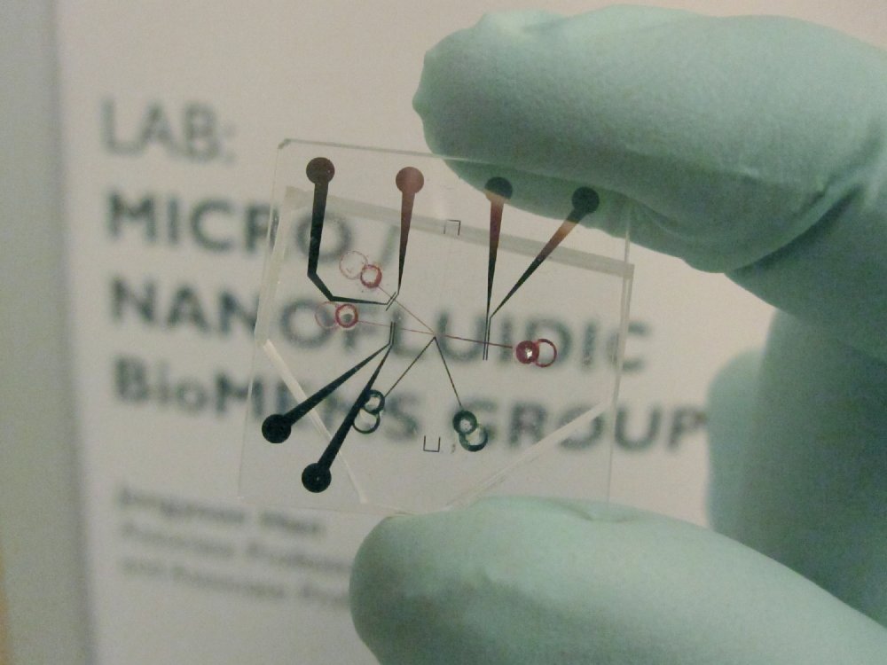 |
| A new energy-efficient desalination system utilizing ion concentration polarization as the core mechanism. Both salts and any charged colloids in seawater are diverted into the brine channel, leaving the other channel relatively salt- and particle-free. The system could be made portable and operated by current battery technolgy. © Credit: Sung Jae Kim/Jongyoon Han - Nature Nanotechnology |
Sung Jae Kim from MIT and colleagues have come up with an alternative. Instead of using a membrane to separate the salt from the water they are using electricity. They have made a y shape of channels about half a mm wide. The dirty water comes in along the stem of the Y and on one of the two arms is a nafion nanojunction. This is a material which will let positively charged ions flow through it but not negative ones. This is made negatively charged and a current flows along the arm in the wrong direction. This leaves lots of negatively charged ions piling up and flow up the other arm. These take any other charged species with it, including the ions in salt and bacteria and other contaminants leaving water with 99% of the salt removed.
It isn't as efficient as reverse osmosis, but it is intrinsically a much smaller scale process so you could build a machine consisting of maybe 1600 of these junctions to purify maybe 15l of water a day and because the contaminats are pushed away from the sensitive parts of the system it doesn't clog up like a membrane.
06:29 - Why Age offers Protection from Pandemic Flu
Why Age offers Protection from Pandemic Flu
Research looking at the shape of the H1N1 pandemic flu virus has revealed why seasonal flu vaccines don't offer any protection, but also suggests why the older generation are more likely to have immunity to the pandemic virus.
Two papers, one published in the journal Science by Ian Wilson and colleagues, the other in Science Translational Medicine by Gary Nabel et al., looked at slightly different aspects of the virus, and together make some interesting conclusions.
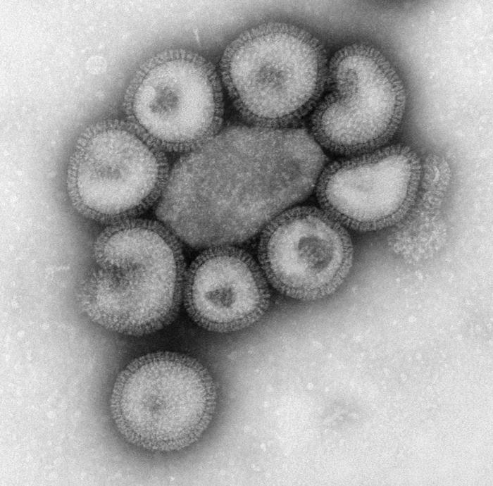 Writing in in Science Translational Medicine, Gary Nabel and colleagues exposed mice to seasonal and pandemic flu strains both 1918 and 2009, and analysed the antibodies they produced in response. They found that the antibodies against pandemic viruses protected the mice from both the 2009 and 1918 pandemic flu, but that seasonal flu antibodies offered no protection from pandemic viruses. They did, however, protect very well against the against seasonal flu. This tells us that there is something about the structure of both pandemic viruses that antibodies can lock onto - something they don't share with the seasonal flu virus particles.
They found, and these results were confirmed by the analysis of the crystal structure of the viruses published in Science, that the antibodies were attaching to a protein that sits on the outside surface of the virus - called the spike protein - so called because it helps to infect cells. Interestingly, the structure of the spike protein is very similar in both the 1918 and 2009 pandemic viruses. They share a nearly identical epitope - that's a region of a molecule with a defined shape to which an antibody can attach.
In the seasonal virus, however, the spike protein is obscured by two sugar groups - this stops the host immune system from recognising the virus, and is one reason why vaccines designed for pandemic viruses offer no protection from seasonal forms.
Not only does this tell us why you don't develop immunity to both types of flu, but it also hints at why older people were more likely to be protected against last year's H1N1 pandemic - exposure to the 1918 strain as a child may well have attuned their immune system to the shape of the spike protein, and therefore offered some immunity.
08:55 - Snail inspired coatings
Snail inspired coatings
Ceramics - materials like pottery - have all sorts of very useful properties, they are very hard, resistant to heat, some are very strong etc. but their use has been very limited because they are very brittle. They are not tough which means they can't absorb energy from an impact without shattering, and once a crack starts in the ceramic it keeps on going to the edge of the material.
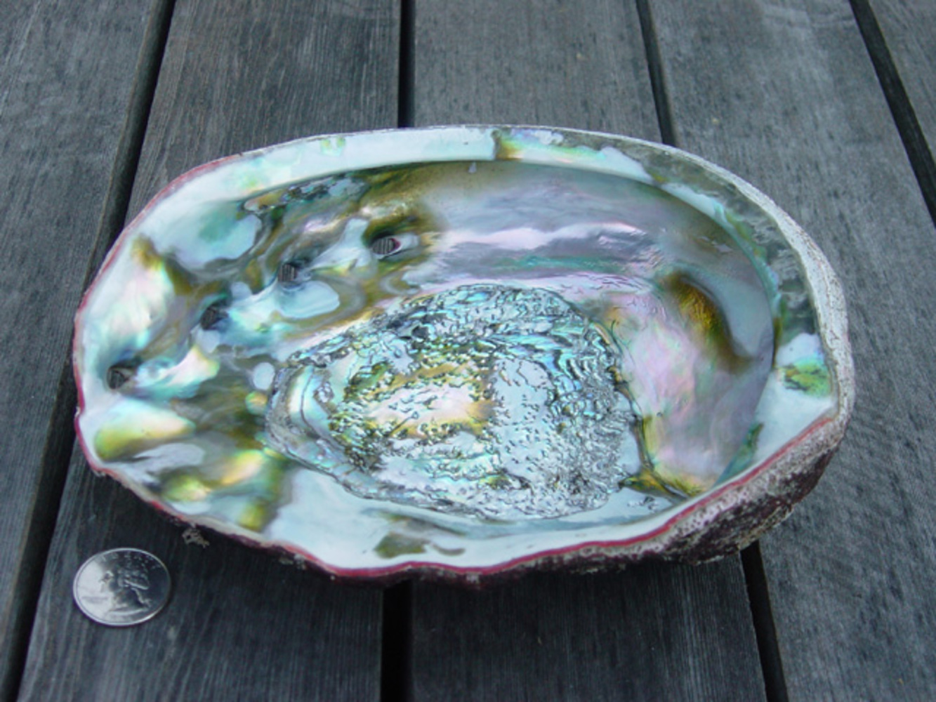 For a while scientists have been fascinated by shelled animals, their shells are made up tiny plates of the brittle ceramic calcium carbonate - effectively limestone - mixed with proteins to give a very tough material which can survive an incredible amount of abuse. This is because a crack can only travel through a single plate and then stops at the edge. Many scientists have been interested in these properties and have tried making various materials in the lab with interesting properties.
Andreas Walther, from Helsinki in Finland, has managed to make a similar structure out of a clay which is made up of microscopic plates and PVA glue that is very easy to make and could be painted onto walls or an aircraft skin.
The properties are very similar to fibreglass but it can be applied more easily and is much thinner. Apparently tests with flamethrowers also show that it is very fire resistant as well.
10:38 - How the Heart got its Arteries
How the Heart got its Arteries
with Dr Paul Riley, University College London
Ben - Also in the news this week, a paper in the journal Nature overturns a 100-year-old misunderstanding about how the arteries that supply the heart with blood first develop. Paul Riley from University College London is the author of the News and Views article that accompanied the paper and he joins us now. Hello, Paul.
Paul - Hi.
Ben - So first of all, what has been the prevailing idea for the last hundred years, if not more, about how coronary arteries actually form?
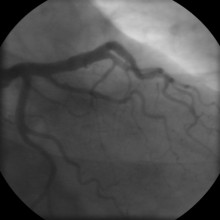
Paul - Well, it's an evolving idea really. So initially, the coronary arteries were thought to bud off from the main vessel aorta that serves the rest of the body. That was disproven when, actually, vessels were shown to in growing to the aorta, so the reverse process. And then more recently, over the last 20 years or so, studies in chicken and quails have shown that a transient organ called the pro-epicardial organ, which sits just above the developing liver at the base of the heart if you like, that contributes cells which can give rise to the epicardium which surrounds the heart. Those cells subsequently give rise to endothelial cells which make up the coronary arteries. So that was the most common idea as it stands before this paper.
 Ben - And what have they discovered now? What's new about this paper?
Paul - Well a previously unsuspected source really. What they've shown is, by very carefully tracking individual cells within the mouse heart through genetic tagging, they've shown that cells can emerge from the inflow region - a region where there's a large venous input called the sinus venosus - and that these cells can de-differentiate, as vein cells, and actually give rise to new cells that then become artery-like and actually form the developing coronary artery. So it's a completely unsuspected source of cells and moreover, the fact that they can de-differentiate and change their fate from veins to arteries is the real crux of the finding.
Ben - So these cells start out as a vein cell.
Paul - That's right.
Ben - And then they turn into just a general cell and what do they do then? Do they migrate themselves or do they grow through into the tissue?
Paul - Yeah. I mean, you have to get the de-differentiation, the change of the sort of vein cells. So they have to de-differentiate to become more progenitor-like. And then they have to migrate inward and start to form a plexus where they're connected into the muscle tissue of the developing heart and then they become fated to become arterial cells. So they start to turn on characteristic markers, which suggests that they are becoming arterial-like. That network then progresses throughout the developing muscle of the heart to form the coronary artery network.
Ben - Now, what does this tell us with regards to adults with heart condition because all of this work has been looking at the embryonic development - where these arteries first comes from. But of great concern to many, many people is what happens when these arteries becomes blocked or become damaged later in life as an adult. Can we learn anything from this work that could help us to treat people?
Paul - Well I think there's a very basic principle that if you understand how the heart is put together, both at the coronary vessel side and also the developing muscle, then understanding the cell behaviour and the signals that trigger that can be applied to the adult setting. So, some of these cells are present in the adult heart and therefore, if we understand how to re-trigger the process of making new vessels, then obviously, we're going to position where we can re-vascularise an injured heart that has lost blood vessels and also muscle after a heart attack. So, it's fundamentally important to understand how these vessels are made in the first place to then go back into the adult, track a similar cell population and then be able to stimulate with appropriate signals to make new vessels. So it's completely translatable although some way off in terms of the realistic research goal. But this is a major step in the right direction and through understanding, taking these studies further, how they switch from veins to arteries and understanding the signals from neighbouring tissues to allow this to happen should be able to do then be fully translated into the adult setting and hopefully set up a therapeutic by way of making new blood vessels.
Ben - Very promising stuff. Obviously very early stages but very promising. Thank you ever so much Paul. That was Paul Riley from the UCL Institute of Child Health. You can find his News and Views article and the paper itself which is by Kristy Red-Horse and colleagues at Stanford University. You can find them both in this week's Nature Magazine.

15:23 - Contrails Creating Clouds
Contrails Creating Clouds
with Dr Jim Haywood, Met Office
Ben - Most of us are familiar with the long trails left behind by airplanes as they pass overhead. But those trails, or contrails as they're called, can actually give rise to clouds. We're joined by Dr. Jim Haywood who's from the Met office. Now thank you for joining us, Jim. My first question really to get a broad idea is how were clouds normally formed?
Jim - Well, clouds almost invariably form when the air that contains the water vapour cools. Cooling is almost always initiated by a lifting action. For example, air flowing over mountains can cause the air to cool to such an extent that the water in it condenses, forming a cloud. Alternatively, you can have things like cool air undercutting warm air and forcing it to rise in frontal systems associated with low pressure systems in the mid latitudes. So really, it's just a case of air being forced to cool, the relative humidity - as meteorologists call it - exceeds 100% and the water in it condenses.
 Ben - When we see these big lines up in the sky, these contrails from airplanes, what are they actually made of?
Jim - Obviously, most clouds that we can see from down here are made up of water droplets. Contrails tend to be made up of ice crystals that grow when the conditions are favourable.
Ben - How do these then go on to create a cloud?
Jim - What you can get is - under certain conditions, which is basically cold and moist conditions - the ice crystals that are initially formed by the aircraft contrail can grow. It's a bit like a physics experiment that you probably did at school where you grow crystals of copper sulphate or things in supersaturated solutions. That's exactly what's happening here. When the conditions are right, it's cold enough and moist enough up in our atmosphere then the crystals that are initially injected can just grow tremendously and spread with the metrological flow.
Ben - So we're not talking about lots of individual particles like we will be for a normal cloud. This is actually a very large ice crystal that just happens to be light enough to float about. Is that right?
Jim - The ice crystals, when they're initially injected are about a 1000th of a millimetre typically in terms of size. But as they grow, they can actually get many times that up to about 100 microns. So, they do form very large crystals which are important in the earth's radiation budget.
Ben - These clouds are a bit different than normal clouds. How do they affect the weather? Are they rain clouds? Are we likely to see rain from them or just perhaps a bit of shading or will they not affect us much at all?
Jim - Well they do affect us in terms of the amount of sunlight that they let through. That's quite important. They tend to reflect sunlight back out to space and lead to a cooling of the weather and consequently, the climate. But they also trap out going long wave radiation. So, heat radiation if you like, rather like the greenhouse effect. So there's these two competing effects. You've got the reflection of solar radiation or sunlight back out to space and you've also got a greenhouse type of effect. And what's critical is really the balance between the cooling from the reflection of solar radiation and the warming due to the greenhouse type of effect of these crystals.
Ben - So if they need particular conditions in which to form, does this mean that certain flight paths are actually more likely to create these clouds and therefore, we're more likely to have this warming effect or this reduction of sunlight effect in certain areas?
Jim - Yes, that's right. I mean, one of the area that's particularly good for forming cirrus types of particles - these ice crystals - actually coincides with the air traffic corridors, particularly the one linking North America with Europe. That's a particular area that's good for crystal formation and crystal growth.
Ben - We've had a very, very relevant question from Neil Briscoe. He said that he heard a while ago - thanks to the 9/11 attacks - when they grounded all the flights, people were able to work out the contrails during daylight hours, helped to prohibit warming by reflecting light back out into space. But during night time, they actually increased warming. Is this the same stuff that we're talking about here? Does it matter whether it's day or night?
Jim - Yes, it does indeed. It's exactly what that question is about. Really, we're talking about a cooling, if you like from the reflection of sunlight and a warming during the night time which can cause a reduction in what's called the diurnal temperature range. After 9/11, there was certainly evidence of a reduction in the diurnal temperature range from a particular study. But it's quite difficult to disentangle that signal, if you like from the natural meteorological events that can occur. And when they looked at it in a little bit more detail, it became almost impossible to distinguish from other events that had nothing to do with 9/11. You still could see this signal in diurnal temperature range, just due to the natural variability of the atmospheric system.
Ben - So it may have an impact that we can't see because it's no bigger than noise.
Jim - It's just difficult to detect. That's right.
Ben - And speaking of detecting it, how do we actually study these things?
Jim - Well, we study it by a number of ways. We've been simulating these contrails and contrails induce cirrus in the state-of-the-science atmospheric models that we use at the Met office and the Hadley Centre for Climate Change. We've also been having a look at various different aircraft measurement campaigns. I'm involved with an aircraft measuring campaign where we're trying to create contrails and actually measure the amount of reflected sunlight, and the amount of infrared heat energy that these contrails affect. So, you can do it from a purely modelling perspective but it's always better to base it on objective measurements.
Ben - And, just finally, these contrails obviously tend to stay in one place in the sky. When they go on to create this cirrus type clouds, do they also stay where they were created or do we find that they drift across the country and have that sort of effect on a slightly wider area?
Jim - Yes. We studied one particular contrail that was formed by an Awacs aircraft over the north sea and what we found was although that aircraft had only travelled 1500 kilometres, the area of cloud that it created was actually over 50,000 square kilometres. This area of cloud - this was created last March - you could see quite clearly being vectored over the UK and lasted for several hours. It actually lasted for around about 18 hours before the ice crystals started to dissipate.
Ben - So that's certainly something to think about next time you're 30,000 feet above the UK. You might actually be making it literally cooler for us down on earth in the daytime, possibly a little warmer at night. That was Jim Haywood. He's from the Met Office.
Do aircraft contrails negate global warming?
We put this to Dr Jim Haywood, from the Met Office: Ben - Does it matter whether it's day or night?
Jim - Yes, it does indeed. It's exactly what that question is about. Really, we're talking about a cooling, if you like from the reflection of sunlight and a warming during the night time which can cause a reduction in what's called the diurnal temperature range. After 9/11, there was certainly evidence of a reduction in the diurnal temperature range from a particular study. But it's quite difficult to disentangle that signal, if you like from the natural meteorological events that can occur. And when they looked at it in a little bit more detail, it became almost impossible to distinguish from other events that had nothing to do with 9/11. You still could see this signal in the diurnal temperature range, just due to the natural variability of the atmospheric system.
Ben - So it may have an impact that we can't see because it's no bigger than noise.
Jim - It's just difficult to detect. That's right.
24:09 - Forecasts Insure Against Bad Weather
Forecasts Insure Against Bad Weather
with Frank Roberts, Eurotempest
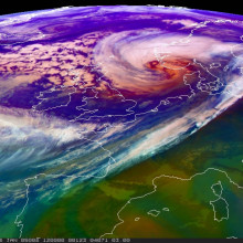
Dave - Now moving away from clouds and over to the extremes of weather, more specifically windstorms. For example, the winter storm Anatol blew through Europe, including the UK, Sweden and Germany, and caused economic damages and approximately 2.9 billion Euros. Much of this was claimed on insurance. And so, insurance companies are very interested in predicting these extreme weather events. A team from the University College London's Climate Extremes group have created just the tool to do this and formed the company Eurotempest to help European insurers to help prepare for the billions of pounds weather damage that may be coming their way.
Meera Senthilingam went to visit them in London and met Operations Director, Frank Roberts to find out what they need to know for these predictions and how these weather forecasting data is collected in the first place.
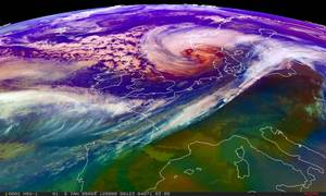 Frank - Well in the first instance, the modelling agencies - that's the national meteorological agencies of any country and in the UK, that's the UK Met office - will collate observations from all over the world. I think the Met office collect about half a million per day at the moment and that can be from any source. So satellites, weather balloons, surface observation stations, buoys at sea, aircraft. From that, they need to build a complete picture of the atmosphere because obviously, these observations were only taken at certain points, and this is what they called the assimilation process. They have complex mathematical models to do this. And from that, they will then use what they call their numerical weather prediction system. The atmosphere is broken into - on the surface- latitude longitude grid squares, so just like you're looking at a map, and various levels, so you have these cubes of atmosphere. You apply then the physical equations to each cube of the atmosphere in order to be able to predict the various parameters that you're interested in.
Meera - So parameters such as?
Frank - Temperature, wind speed, wind direction, humidity, the amount of rainfall that you might expect, cloud cover...
Meera - To what resolution is it usually possible to predict the weather? Say, to what area?
Frank - Well the current global model that the UK Met office use is on the resolution of about 60 kilometres.
Meera - Here at Eurotempest though, you focus on the parameter of wind speed and essentially then try to predict windstorms across Europe?
Frank - Yes, that's right. We focus on wind specifically because we provide a summary of information, not for the general public but to the insurance industry. Severe wind causes, over the long term average, about 80% of the insurance loss from natural hazards in Europe.
Meera - So how do you go about collecting data for wind speed and therefore, what kind of information are you putting together to help insurers plan for windstorms that may be coming up?
Frank - Okay, well we take the surface level output from the UK Met office numerical weather prediction model for wind speed and from that, build up a picture of the wind speed forecast for the country in the coming five days, we go out to five days. Also, our customers who are insurance companies have provided us with information about where their insured properties are. So, by postcode, we have information about what we would call their exposure. That's the total value of the insured properties in those locations. And then we use what we call a vulnerability model. This is built up from historical observations of claims and wind speeds in given locations and it's a statistical model which allows us to estimate the proportion of buildings which will be damaged in a given postcode area from a given wind speed. So, you can't say necessarily, of course, that this particular building is going to be damaged, but if you've got enough buildings of a certain type in a large enough area, then you can say what proportion of damage is going to occur. We can do that for a country as a whole for each of our customers and then they have a good idea of what the ultimate payout is going to be from a severe wind forecast.
Meera - What kind of wind speeds does it take to really damage property?
Frank - Well typically, the serious damage really only begins at about 60 miles per hour and that's not particularly usual. It's not an everyday occurrence in the UK. Insurance companies tend to get interested at around about 40 miles per hour, and you can get small levels of damage at those sorts of wind speeds as you might expect - a few tiles or the odd branch breaking a window, or something like that.
Meera - Now, in terms of actual damages and costs, how much damage can be done by wind?
Frank - Well in the UK, on average, it's about half a billion pounds a year which is obviously an awful lot. You might remember fairly recently, just at the beginning of the month, there was this severe windstorm in France, called wind storm Cynthia. Now the estimates for their losses from that are well over a billion pounds.
Meera - So, as well as helping insurers prepare essentially for maybe a large amount of payouts that are about to come out, how else does this benefit them?
Frank - They can prepare for the large amounts of payouts but of course, if there's a severe event, there is likely to be an awful lot of claims coming in all at once. So that helps them to manage their human resources to make sure that they've got enough people in their call centres to be able to answer the phone, to answer the claim from each of their customers. It's obviously extremely important to them that they're able to settle claims very quickly from a customer satisfaction point of view, but also from the point of view that the longer the damage is left unfixed, the higher the bill tends to be ultimately.
We also provide a system for insurers which allows them by postcode and date to interrogate the observation data set. So, when a claim comes in, they will be able to look at their system and they'll see the distribution of observation stations around the postcode, and it will report the wind speed or the rainfall, whatever it might be, so they can check back to see that there were damaging conditions prevailing on the day that the damage happened and then they can validate the fact that the damage that's been reported by the insured is actually consistent with storm damage.
Meera - But now, what makes this vulnerability model better than insurers just keeping an eye on weather forecasts?
Frank - Well the public and media weather forecasts are specifically designed for public consumption and for public safety, and that will be couched, often, in terms of "we may see 80 miles an hour gusts at peak". It doesn't really say in any great detail where exactly that might be expected. And that's a sort of high resolution information you need to predict for an insurer. So, translating a verbal media forecast into a forecast of loss is actually very difficult for anybody to do and in the past, we've had examples from customers who said that had they only had the media forecast available and tried to interpret that in terms of what their exposure was, they would've been out by a factor of 10, compared to what we were correctly saying.
Dave - With all that saving, hopefully, our insurance payments will be more efficient in the future and hopefully a bit cheaper. We'll have to keep our fingers crossed on that one.
Ben - Indeed, we will. Yes, that was Frank Roberts, Operations Director at Eurotempest talking to Meera Senthilingam.
31:15 - Steering Hurricanes Out of Harm's Way
Steering Hurricanes Out of Harm's Way
with Dr Moshe Alamaro, Massachusetts Institute of Technology
Dave - Now we're going to go and talk to Dr Moshe Alamaro from MIT who's come up with a plan that could in theory be used to steer one of the most powerful forces of nature, the hurricane, away from danger. Hello, Moshe...
Moshe - Hello. Hi.
Dave - I guess the best way to start, what exactly is a hurricane and how do they form?
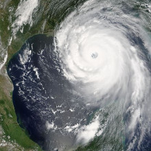
Moshe - Hurricanes in the Atlantic are formed in the mid-Atlantic, eastern Atlantic, and sometimes inside the gulf, the Caribbean Gulf. Then they travel west and eventually north-west and ultimately north. They are part of the global circulation. In fact, in active hurricane seasons, the temperature in Iceland is higher than usual and so, hurricanes are an essential part of the global circulation.
Dave - So they're moving heat around. What's actually the structure of hurricane itself?
Moshe - Well, the description would take too long, but the genesis of hurricanes is not  fully understood. It starts as a tropical storm. There are about 100 tropical storms in the Atlantic area. We cannot intercept all of them because they are beneficial. They bring rain to central America and the Southern United States. So if ever we are going to intercept hurricane, it will be when the hurricane has formed, because only 10% of the tropical storm are about become hurricanes. We will need to intercept the hurricane when it is in its full powers.
Dave - So, how are you intending to intercept them and affect them?
Moshe - Okay. Just to give you some numbers, the power of a hurricane is on the order of 10 million megawatts. The power of the combined electric grid of the world is only 3 million megawatts which is about a third of the typical power of a hurricane. So fighting a hurricane head to head is hopeless. But they can have an Achilles heel - a hurricane is not robust in its track and its intensity. So we found by simulation that if we change slightly the atmospheric conditions surrounding the hurricane, we would be able to divert the hurricane from its track to another track that might be less damaging.
Dave - So,a hurricane is actually quite sensitive to the conditions around it. Is this the reason why they're so hard to predict, where they're going to go naturally?
Moshe - Yeah. Now it's less hard to predict because we have a very good information about the surrounding atmospheric conditions. But as I said, it's enough to change slightly the temperature or humidity of the atmospheric conditions to cause a change, it could be a substantial change, and that was found through some computer simulations that we have done. Now, about the physical means to create perturbation to the hurricanes, there was a program which was ongoing until 35 years ago by NOAA (The US National Oceanic and Atmospheric Administration) and that program was called the Storm Fury Project. In this project, the cloud of the eye of the hurricane was seeded by silver iodide, and it was a project that was ongoing for 23 years.
What we tried initially is, instead of injecting silver iodide - which is a nucleus for freezing - [we tried] to inject ice by carrying water in aeroplanes, in high altitudes, freezing the water, and then using the ice instead of silver iodide.
Eventually, we found that the project Storm Fury was abandoned because it was already found that there is ice in the cloud and adding additional ice or silver iodide would not make any impact. But nevertheless, this development led to important technology that had nothing to do with hurricanes.
The second implementation or experiment that we did is with a material called a monolayer. It's a material that you place on water. It propagates and propagates until the width of the material is literally one molecule. And 25 grams of this material is enough to cover a square mile of water surface. The monolayer is effective up to 30-miles per hour but it's not effective in hurricane speeds.
Dave - So you're basically trying to affect the evaporation which would drive the hurricane - with hot water vapour rising - which actually powers the hurricane?
Moshe - Exactly. The water vapour rising and condensating and releasing of the evaporation heat is the source of the energy in the hurricane.
Dave - So what have you found which might actually work?
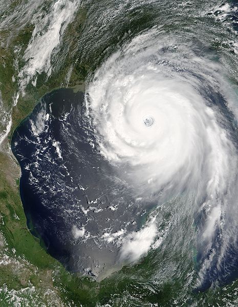 Moshe - Until now, we didn't find any method that which is working. We are right now working on our 4th method which is spreading carbon black or soot on the top of hurricanes from aeroplanes and we have shown that this might change the thermodynamic of the hurricanes, lessen the intensity of the hurricane and/or be able to divert its track from one track to another.
Dave - Brilliant. How practical is this? How many planes would you need and I'm guessing the other big problem is if you drive hurricane into somebody else's city, they're going to be unhappy?
Moshe - Yeah. These are the major legal, ethical, political, and international issues with hurricanes because if this hurricane comes to one region, say a populated region, and then we divert it to a less populated [region], but in the less populated, some people are damaged. They will claim that the hurricane is not an act of God anymore, but we caused it.
Dave - And that could cause some really serious legal issues. Thanks Moshe. That was Moshe Alamaro from MIT on how we could theoretically steer hurricanes, if we can get the lawyers out of the way first.

DIY Rainbow - how a rainbow forms
Can cooler water from the deep oceans be used to stop hurricanes?
Dave - In theory, if you could reduce the temperature of the surface of the sea, that's going to give less energy to the air above it, less upwelling of air, so you're going to get much weaker upwelling, and you could stop a hurricane forming. However, hurricanes, as Moshe was saying, can form anywhere over the whole of the Atlantic, all the way into the Gulf of Mexico. So you'd have to cool down the whole of the surface of the ocean which is going to be a ridiculously huge engineering job. Also, it would only work for a few years because eventually you would warm up the deep ocean, you would cause all sorts of havoc and alter the balance of nutrients of the ocean. And, as Moshe was saying, small storms are actually very important for us because they bring water, rain, into the whole of the west side of the Atlantic. Ben - Not to mention the fact that the temperature structure of the oceans are actually incredibly important for the currents, and things like what we call the conveyor system that moves warm and cold water around the world. Dave - If you're not careful, you'd end up freezing Northern Europe where we are because you might break the north Atlantic conveyor, the gulf stream. Ben - That's another reason why this is unethical and legal minefield. Not only could you send a hurricane into somebody but you could also freeze England by accident.
At what temperature will water split into hydrogen and oxygen?
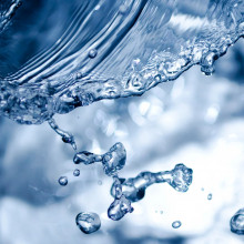
Dave - You can do it electrically with about 1.3 volts of electricity. However, to do it thermally, you've got to heat it up to over 2,000 degrees centigrade. It's one of these things whereby the hotter you get, the more complete the dissociation - you split the molecules up. It is actually a suggested way of making hydrogen - you heat up water at very high temperatures. You then have to somehow separate out the hydrogen and oxygen because otherwise, it's easily hot enough to burn and condense back to water again, so you need some kind of membrane to separate the two. This does exist - it's a special kind of ceramic membrane, and you can separate the two gases and you get hydrogen out.
So, yes, it can happen somewhere about 2,000 degrees C.
Ben - And would it help if you were to add a catalyst? I know that they've been looking at using platinum to help do this. You find catalysts that help reactions happen at different temperatures. Could we find the right catalyst that therefore meant it didn't need to be quite so hot as 2,000 degrees?
Dave - Catalysts certainly help with electrolysis, doing it electrically. My knowledge of high temperature chemistry is very limited, but I think the fundamental thing that you're working against is the actual energy you need to split apart water molecules and thermally, that's an awful lot of energy. So, I would be surprised if you could gain that much.

48:46 - Is a human bite worse than a dog bite?
Is a human bite worse than a dog bite?
We posed this question to Dr Nick Brown, Consultant Medical Microbiologist, and Andreas Karas, also a Consultant Microbiologist, both from the Health Protection Agency...
Nick - Well, you might think that the dog bite would be the more dangerous and certainly of course, in terms of trauma, and particularly if related to attacks, they can be very nasty.
But, actually, in terms of infections, human bites have a very high incidence of complications. And so, many people would actually say that human bites are nastier than dog bites.
All of our mouths, and all animal mouths, are full of bacteria all the time and the sorts of organisms that cause this infection are the things like Streptococci and Staphylococci particularly.
But the importance of the bite, of course, is that, because of the teeth and the trauma that's associated with it, then those organisms can be introduced deep into the tissues where they can replicate and cause infections.
Andreas - The question about whether a dog bite or human bite is worse would depend largely on where in the world you are.
If you were in the developing world, rabies becomes a major factor and you would much rather be bitten by a human where rabies is much less likely. If you were in another part of the world, it would depend a lot on the site of the bite. Human bites in my experience are always much worse as they're often on the face, genitalia, really bad parts of the body, so probably better to go for dog.
But if you had an equivalent bite for the same size bite on let's say your leg by a human or a dog, it's probably much of a much-ness.
Generally, humans probably have a more diverse flora and larger number of different organisms. Dogs have a lower number of organisms. But, either of their mouths would have hundreds of different bacteria in them of different types, and the ones that do the damage are really anaerobes.
Dogs have a particular organism, called Capnocytophaga canimorsus, which - if it gets into your bloodstream - can give you very severe blood poisoning.
And there's a lot of talk about human bites being worse and dog bites. Probably slightly true, not much evidence to prove that though.
I would say, probably if I were to choose, I'd go for dog in the developed world...
Diana - In some cases, human bites can be worse than a dog bite, but this is dependent on how deeply the teeth penetrate the skin. There are some nasty bacteria living in our mouths, but populations vary between individuals almost as much as they vary between species. But if your dog has rabies, then you're probably better off being bitten by a person. Many of the infections hospitals see which come from human bites are actually where someone has punched another person in the face, but their skin was broken when it came into contact with the recipient's teeth.






Comments
Add a comment